When Hurricane Beryl struck the Grenadine Islands on July 1, it was the first Category 5 storm (the most destructive rating on the Saffir-Simpson hurricane scale) ever to hit the tropical Atlantic, packing winds of up to 150 mph (240 km/h) and a massive storm surge.
An active hurricane season in 2024 was predicted well in advance. However, the speed at which Beryl intensified, from tropical storm strength with winds averaging 70 mph to major hurricane status with winds of 130 mph in just 24 hours, surprised scientists.
“Beryl is a storm more typical of the heart of the hurricane season than June, and its rapid intensification and strength were likely driven by unusually warm water,” said Brian Tang, an associate professor of atmospheric sciences at the University at Albany, State University of New York.
Read more: Hurricane Beryl’s rapid intensification and Category 5 winds so early in the season are alarming: Here’s why more tropical storms are strengthening
Research shows the world is warming faster due to record fossil fuel emissions, bringing even more nasty surprises our way.

This summary of The Conversation’s climate coverage is taken from our weekly climate action newsletter. Every Wednesday, The Conversation’s Environment Editor writes Imagine, a short email that delves into just one climate issue. Join the 30,000+ subscribers.
In a narrow band of the Mid-Atlantic where most hurricanes form, sea surface temperatures are unusually high. In fact, the ocean’s heat content — a measure of how much energy is in the surface water that hurricanes draw from — was close to the September average on July 1.
Read more: World’s fourth mass coral bleaching event underway, but well-connected reefs may have a better chance of recovery
Water accumulates heat slowly, so it is alarming to see ocean heat near its usual peak at the start of summer. If the tropical Atlantic is already producing storms like this, what can the rest of the hurricane season bring?
A top season
“If the National Hurricane Center’s early forecast, released on May 23, is correct, the North Atlantic could see 17 to 25 named storms, eight to 13 hurricanes and four to seven major hurricanes by the end of November,” said Jhordanne Jones, a postdoctoral researcher studying how climate change is affecting scientific efforts to predict hurricanes at Purdue University.
“That is the highest number of named storms in a forecast for the season.”
Read more: Hurricane forecast points to dangerous Atlantic season in 2024 as La Niña and a persistently warm ocean combine to create intense storms
Seawater hotter than 26°C (79°F) is the lifeblood of hurricanes. Warm, moist air is another requirement. But that’s not all these monsters need to reach the limits of their ferocity: steady winds in the upper and lower atmosphere are also necessary to keep cyclonic storms spinning.
A shift from El Niño to La Niña – two opposing phases of a long-term temperature pattern in the Pacific Ocean – is expected later this summer. This could dampen trade winds that would otherwise tear apart a hurricane’s vortex. Jones says:
“La Niña can signal an early start to the season, but it can also signal a longer season, as La Niña – together with a warm Atlantic Ocean – maintains a hurricane-friendly environment earlier and longer in the year.”
You might expect that global warming would bring more hurricanes. But that’s not what research has found so far, according to Ben Clarke (University of Oxford) and Friederike Otto (Imperial College London), two scientists trying to attribute the role of climate change to extreme weather events.
“Warm, moist air and high ocean temperatures are abundant in a rapidly warming world. Yet there is no evidence that hurricanes are becoming more common, and scientists do not expect this to change with further climate change,” they say.
Instead, hurricanes that do occur are more likely to be large storms like Beryl. Conditions for breeding hurricanes are also found farther north and south of the equator, as the ocean warms rapidly everywhere. And Atlantic hurricanes can form outside the season (June 1 to November 30) in which people expect them.
Read more: Hurricane Ian: How climate change is making tropical storms in the North Atlantic worse
“There is also evidence that they are moving more slowly and increasingly shutting down completely near the coast, leading to more flooding because more rain falls in one place. This was one of the reasons why Hurricane Harvey, which hit Texas and Louisiana in 2017, was so devastating,” Clarke and Otto say.
The three deadly hurricanes (Harvey, Irma and Maria) that battered the Atlantic Ocean in rapid succession that summer gave people little respite. These “storm clusters,” as climate adaptation researcher Anitha Karthik (Edinburgh Napier University) calls them, are a growing weather trend that is making hurricane-prone areas increasingly inhospitable.
Read more: Major storm clusters growing – what this means for hurricane hotspots
Climate Colonialism
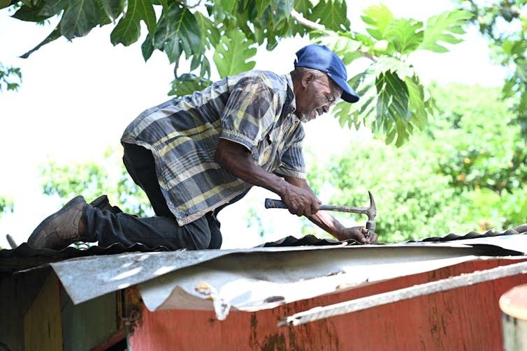
“When Hurricane Maria hit the eastern Caribbean island of Dominica in 2017, it caused devastation unimaginable for larger countries,” said Emily Wilkinson, a climate resilience expert at the University of the West Indies.
“The Category 5 hurricane damaged 98% of building roofs and caused US$1.2 billion (£950 million) in damage. Dominica effectively lost 226% of its GDP overnight.”
Dominica pledged to become the first climate-resilient nation, and began rebuilding homes, bridges and other infrastructure. Preserving the forests and reefs that catch rain, wind and waves was a priority, Wilkinson says. But in trying to build a sustainable future from the wreckage of Maria, Dominica had to grapple with its past as a European colony — a fate shared by many small island states in the Caribbean and elsewhere.
Read more: How a small Caribbean island is trying to become hurricane-proof
“Exposure to hazards is about the same across most Caribbean islands, but research shows that poverty and social inequality dramatically increase the severity of disasters,” say Levi Gahman and Gabrielle Thongs, lecturers in geography, also at the University of the West Indies.
According to Wilkinson, Dominica was faced with a British-imposed plantation economy that squandered the island’s productive potential and caused wealth to seep abroad.
“Yet Dominica also has the largest remaining indigenous community in the Caribbean, and the Kalinago people practice agricultural practices that combine crop diversification with planting methods that help stabilize the slopes,” she adds.
Read more: In the Caribbean, colonialism and inequality make hurricanes hit harder
Climate-vulnerable states can take advantage of such benefits to navigate an uncertain future. But the experiences of Caribbean islands show how a so-called historical process like colonialism continues to claim lives in the present.
The increasing storms will make the demand for “climate reparations” to the formerly colonized world by rich countries, which have contributed most to the climate problem, even more urgent.
This article is republished from The Conversation under a Creative Commons license. Read the original article.
